Victoria Trail

What?
~90 unpaved kilometers of mostly unmolested North Saskatchewan River valley.
Why?
Finding gravel roads near Edmonton is not a problem, but finding interesting gravel roads is nearly as difficult as finding hen’s teeth. Your typical road here is arrow straight flat enough to put the horizon about as distant as tomorrow. This is OK for a while, but for those who crave variety, it does get tiresome.
One happy exception that does not require many hours droning down overly crowded highwaysfilled with morons just to get to an interesting road is Victoria Trail.
At this point Edmontonians might be saying What!?.... No, no, not the Victoria Trail lined with strip malls and newly planted suburban neighborhoods between the Yellowhead and 153 Avenue, but the original Victoria Trail between Edmonton and Victoria Settlement, 100 kilometers downriver on the mighty North Saskatchewan.
Finding gravel roads near Edmonton is not a problem, but finding interesting gravel roads is nearly as difficult as finding hen’s teeth. Your typical road here is arrow straight flat enough to put the horizon about as distant as tomorrow. This is OK for a while, but for those who crave variety, it does get tiresome.
One happy exception that does not require many hours droning down overly crowded highways
At this point Edmontonians might be saying What!?.... No, no, not the Victoria Trail lined with strip malls and newly planted suburban neighborhoods between the Yellowhead and 153 Avenue, but the original Victoria Trail between Edmonton and Victoria Settlement, 100 kilometers downriver on the mighty North Saskatchewan.

The North Saskatchewan River valley is gorgeous, more so as it flows through a landscape that is somewhat short on variety. Property owners along the old Victoria trail have not only seen to the maintenance of the old trail for their own pleasure, they have put in a lot of effort to share its beauty and history with visitors. A local historical society, with funding assistance from Canada and Alberta have restored and maintained historical sites and buildings along the trail.
Close enough to Edmonton and surrounding communities to be an easy day trip back and forth, Victoria trail offers a little bit of everything. Mostly well maintained gravel, there is one short single lane stretch that is mostly sand with some washouts about 3 quarters of the way east on the section between Highway 38 and 831. This tiny stretch can be ridden around on other roads for those not comfortable riding on anything but well groomed roads. Anyone with a true dual purpose bike will have no problems anywhere, and any bike and rider combination comfortable with gravel roads will not be overly challenged.
Where?

From Edmonton
Take Manning Freeway (Highway 15) or Old Fort Road to the bridge over the North Saskatchewan River at Fort Saskatchewan/Lamoureux. Take the Lamoureux exit to Lamoureux Drive on the north side of the bridge. Follow Lamoureux road and the river to Range Road 222 - north to Highway 38. East and north on 38 to Township road 564A, right on the north border of the Agrium fertilizer plant. Go east .5 km or so to Victoria Trail.
 |
| Highway 38 and Victoria Trail |
From Redwater, Bruderheim, Highway 28
From Redwater, Bruderheim, Highway 28
Victoria trail crosses Highway 38, Highway 831 and Highway 855 just above the bridges crossing the North Saskatchewan (north shore).
An alternative to following the river on the north shore through Lamoureux past Agrium, is to take the 99 street exit off the Manning into Fort Saskatchewan, to 101 street in the center of town, turn north on 101 and follow it to River road. River road goes through the town’s riverside park complex, campgrounds and recreation areas. Follow it out of town to where it ends in the industrial refinery zone east of town, then head north as far as you can go and then go east to the next road north, repeat, repeat, repeat, your goal is to stay as close to the river as you can get. Eventually you will find yourself on a wonderfully twisty narrow paved two lane road following the river’s south bank that will take you to Highway 38 south of the river.
Heading back to Edmonton, you can find this road from Victoria Trail and Highway 38 by crossing the bridge to the south shore to Highway 830, the first road on the right (west). At the first intersection turn right (west) on Township Road 564A, and follow it back to Fort Saskatchewan. |
| Waskatanau |
Fuel and food
The closest places for riders and bikes to get fueled up, Fort Saskatchewan at the West end, Highway 38, Redwater (North and West) or Bruderheim (South), neither are terribly close, Waskatenau is just a few few kilometers up Highway 831 or Range Road 193A, Smoky Lake is about 10 km up Highway 855 or Range Road 170A.
Stuff to see

Between Lamoureux and Victoria Settlement are plenty of monuments and plaques dedicated to the people places and events of the area.
The western terminus of the Iron Horse Trail is in Waskatanau, which you need to pronounce 'Wasetna' if you don't want the locals to laugh at you. The Iron Horse Trail is part of the Trans Canada trail network. It is restricted to hikers, horses, bikes as in legmotors, quads (#&^%!) and snowmobiles (2X#&^%!!!) but no motorcycles please. This is actually OK, as it is pretty boring on an MC given that it is never more than about 200 meters from Highway 28 (I can't tell you how I know this). But, if you have a horse, quad, mountain bike, snowjoke or sturdy boots it definitely beats taking them down Highway 28. The trail has two branches, one going to Cold Lake the other to Heinsburg.
Beside the trail between Highway 831 and 855, the MacDonald Store and Pine Creek Post Office built in 1908 is now a private residence and a great example of how to do historical preservation and have a nice house. I would like to look this good at 104, but I don't even look this good now.
 |
| MacDonald store and Pine Creek Post Office |
 |
| Mountie Memorial |
A little further downriver from Pine Creek is a ferry crossing monument followed by a monument to the first Northwest Mounted Police, better known today as the RCMP - GRC* who travelled down the Victoria Trail in 1874, and evidently had a tough time of it.
(*GRC does not stand for Gendarmerie Royale Canadien; an acquaintance from North East Alberta informed me that it actually means Gravel Road Cops.)
 |
| The house that wouldn't fall |
The unpavement ends where Victoria Trail crosses Highway 855, the paved part on the east side of the highway goes down a short distance to Victoria Settlement, a historical park where some of the original buildings have been preserved. There are two old graveyards, one up the hill, and another for on the site of a former Methodist mission to the Indians and (non Methodist) Ukrainians.
 |
| Life was hard on the MacDougall Ladies |

On the way home stop in at the Tim's on Highway 21 in Fort Saskatchewan and chat with the cruiser people.

If it is Thursday evening its hot rod time at the PetroCanada at 137 Ave and Fort Road in Edmonton


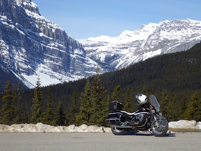
Pix!


Comments
Post a Comment